GeoLens
About
Our Expertise
Platform Overview
Legal View
ENG
FR
Request Access
Decision support at the earliest stage of land acquisition
Avoid allocating capital to unsuitable sites. Identify critical regulatory, environmental, and spatial risks before formal due diligence begins.
The Acquisition Lifecycle
GeoLens is positioned at the earliest and most leverage-sensitive stage of the acquisition process.
PHASE 1
Pre-Due Diligence
Rapid site screening to eliminate non-viable opportunities before capital is committed.
PHASE 2
LOI / Contract
Negotiation and structuring informed by early-stage risk signals.
PHASE 3
Full Due Diligence
Deep technical validation and third-party verification.
PHASE 4
Closing
Final capital deployment into validated, lower-risk sites.
Seamless Workflow Integration
GeoLens integrates directly into your existing land acquisition workflow.
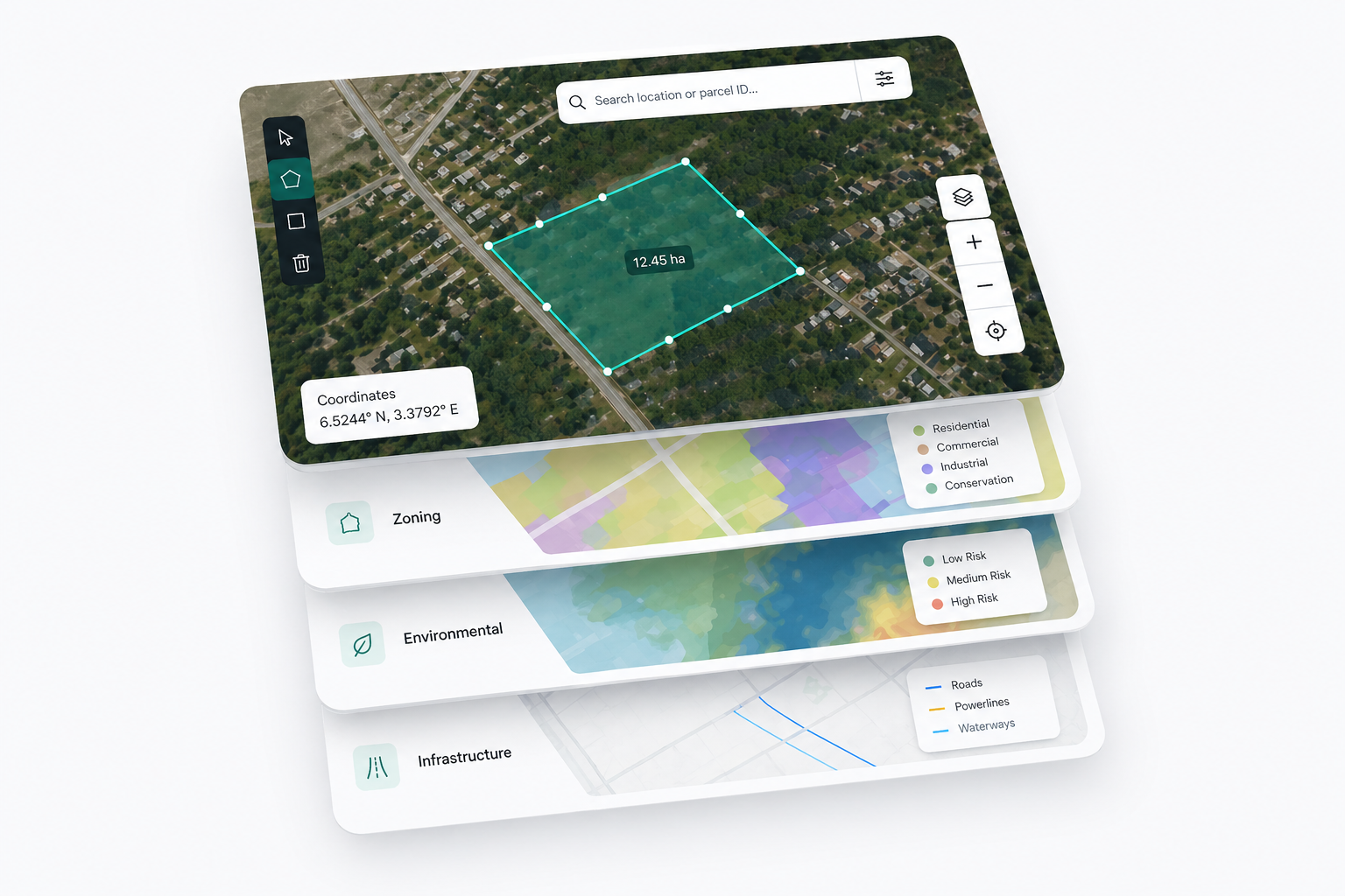
Site Location
01 | 03
Input precise coordinates or parcel identifiers for instant site targeting.
Project Boundaries
02 | 03
Define project boundaries with GIS-ready polygons and evaluation zones.
Contextual Data
03 | 03
Automatically analyze zoning constraints, environmental exposure, and infrastructure proximity.
Built for institutional decision-making
Every GeoLens output is designed to support capital allocation, risk screening, and executive-level decision-making.
Structured
Standardized outputs enable consistent comparison across sites and portfolios.
Explainable
Every verdict is backed by transparent spatial logic and traceable data inputs.
Reusable
Analyses are stored and reusable across teams, projects, and investment cycles.
Committee-Ready
Outputs are formatted for direct use in investment memos and internal approvals.
Contact GeoLens
For analysis requests, institutional partnerships, or general inquiries:
Laurine Leila Chabot
info@geolens.app
tel.:(514) 813-0702
This is some text inside of a div block.
© Copyright GeoLens. All rights reserved 2026. GeoLens Technologies Inc.
.svg)