GeoLens
About
Our Expertise
Platform Overview
Legal View
ENG
FR
Request Access
Turn complex land data into clear decisions.
GeoLens transforms environmental, spatial, and regulatory data into structured insights you can act on.
Three lenses. One clear decision.
Every site is evaluated through three critical risk lenses — to deliver one clear decision.
Regulatory Lens
Identify legal and permitting constraints before capital is committed.
Zoning viability
Permitting risk
Legal constraints
Environmental Lens
Detect environmental exposure and ecological risk early in the process.
Climate exposure
Ecological constraints
Contamination risk
Spatial Risk Lens
Evaluate terrain, infrastructure, and physical viability at scale.
Buildability
Infrastructure access
Physical risk
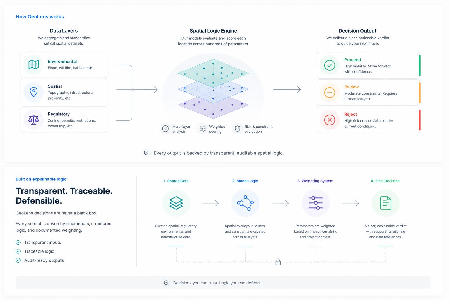
Institutional Verdicts
Three clear outcomes to guide capital allocation decisions.
Proceed
High viability. Move forward with confidence.
All critical parameters align across regulatory, environmental, and spatial lenses.
Capital can be deployed with minimized structural risk.
Review
Conditional viability. Requires expert validation.
Moderate constraints are identified and require further analysis.
Escalate to engineering, legal, or environmental specialists.
Reject
Non-viable under current conditions.
Critical constraints cannot be mitigated within standard project parameters.
Reallocate capital to stronger opportunities.
Contact GeoLens
For analysis requests, institutional partnerships, or general inquiries:
Laurine Leila Chabot
info@geolens.app
tel.:(514) 813-0702
This is some text inside of a div block.
© Copyright GeoLens. All rights reserved 2026. GeoLens Technologies Inc.