Skip to content

Methodology

Classified findings your committee can act on

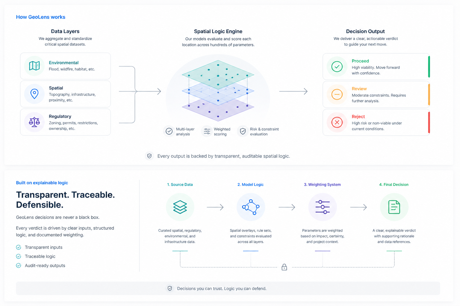
Each constraint is tagged OBSERVED, DERIVED, TO CONFIRM, or UNKNOWN, so you know what you can cite versus what still needs validation.

Find constraints before the offer to purchase, not after.

GeoLens brings preliminary screening forward so teams can prioritize opportunities before committing time and capital. Proximity does not equal capacity: nearby infrastructure is not capacity confirmation.

What we screen

Zoning, environment, and access before diligence opens

Material acquisition factors flagged from connected Québec sources. Field validation remains your responsibility.

  • Zoning and land use
  • Municipal planning context
  • Environmental and wetland constraints
  • Flood and hydrology exposure
  • Road and highway access
  • Utility corridors
  • Protected areas and reserves
  • Cadastre and parcel boundaries

Give your committee classified evidence it can act on

Every finding tagged OBSERVED, DERIVED, TO CONFIRM, or UNKNOWN. Clear evidence classification for committee review.

GeoLens land acquisition screening methodology

What you can cite versus what requires validation

OBSERVED

Measured from connected geospatial or regulatory data you can cite.

ExampleWetland overlap on the parcel polygon from the provincial wetlands inventory: measured percent and geometry you can show in committee.

SourceMELCCFP / Données Québec · wetlands inventory

DERIVED

Deterministic derivation from observed inputs (versioned formula).

ExampleNearest arterial distance in metres from the parcel centroid to the Québec road network: same inputs, same formula, same result on replay.

SourceMTMD / RTSS road network · distance derivation

TO CONFIRM

Weak or fallback signal; validate before committee reliance. Proximity to infrastructure does not equal capacity.

ExampleElectricity servicing proximity outside Montréal, where transmission coverage is incomplete. Treat as a validation trigger, not a citeable capacity fact.

SourceFallback / incomplete municipal servicing coverage

UNKNOWN

Not assessed, not covered, or insufficient evidence for this jurisdiction or theme. UNKNOWN never implies absence of a constraint.

ExampleMunicipal zoning for a city outside the live pilot SOW: we state the gap instead of inventing a designation or claiming no constraint.

SourceCatalog gap · not covered for this municipality

Named source categories in the pilot wedge

Industrial / logistics screening in Longueuil, Laval, and Montréal (+ Repentigny). Named gaps stay named, including flood inventory limits and Montréal-only electricity.

  • Longueuil zoning + industrial parksPlanning
  • Laval CDU type-milieux + constraint layersPlanning / environment
  • Montréal PUM 2050 land-use intensitiesPlanning
  • Montréal electricity network (CARTO_SER)Infrastructure
  • Provincial wetlands, protected areas, roads, CPTAQEnvironment / access
  • Flood: CFM inventory + presence-grid (not QC regulatory polygons)Known limit

Screening outputs support human acquisition decisions. Preliminary until validated by appropriate professionals. Proximity does not equal capacity: nearby electrical or water infrastructure is not a capacity confirmation.